
Westerbach (Kahl)
| Westerbach | |
|---|---|
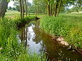
 The Westerbach beneath the Klotzenmühle | |
 | |
| Location | |
| Country | Germany |
| State | Bavaria |
| Reference no. | DE: 247722 |
| Physical characteristics | |
| Source | |
| • location | confluence of Querbach and Huckelheimer Bach in Huckelheim |
| • coordinates | 50°07′39″N 9°14′27″E / 50.127549°N 9.240843°E |
| Mouth | |
• location | in Schöllkrippen in the Kahl |
• coordinates | 50°05′10″N 9°14′41″E / 50.086234°N 9.244710°E |
| Length | 7.2 km (4.5 mi) [1] |
| Basin features | |
| Progression | Kahl→ Main→ Rhine→ North Sea |
The Westerbach is a right tributary of the Kahl in the northern Spessart in Lower Franconia, Bavaria, Germany.[citation needed]
It is 6.3 km (3.9 mi) long (7.2 km including Querbach) and begins at the confluence of Querbach and Huckelheimer Bach in Westerngrund. The Querbach rises in the Arzborn, a small opening in the mountainside on the Hoher Querberg, northeast of Huckelheim, near the border between Hesse and Bavaria. In Schöllkrippen the Westerbach empties in the Kahl.[citation needed]
Together with Sommerkahl, Reichenbach and Geiselbach, the Westernbach is one of the largest tributaries of the Kahl.[citation needed]
Tributaries
[edit]- Querbach (left headstream)
- Huckelheimer Bach (right headstream)
- Hombach (right)
- Schulzengrundbach (left)
- Dörnsenbach (right)
- Herzbach (left)
- Schneppenbach (right)
- Betzenbach (right)
-
 The Arzborn (Spring of Querbach)
 -
 Between Unterwestern and Schneppenbach


See also
[edit]References
[edit]- ^ Complete table of the Bavarian Waterbody Register by the Bavarian State Office for the Environment (xls, 10.3 MB)
Wikimedia Commons has media related to Westerbach.
This article related to a river in Bavaria is a stub. You can help Wikipedia by expanding it. |